Mapping the face of El Capitan
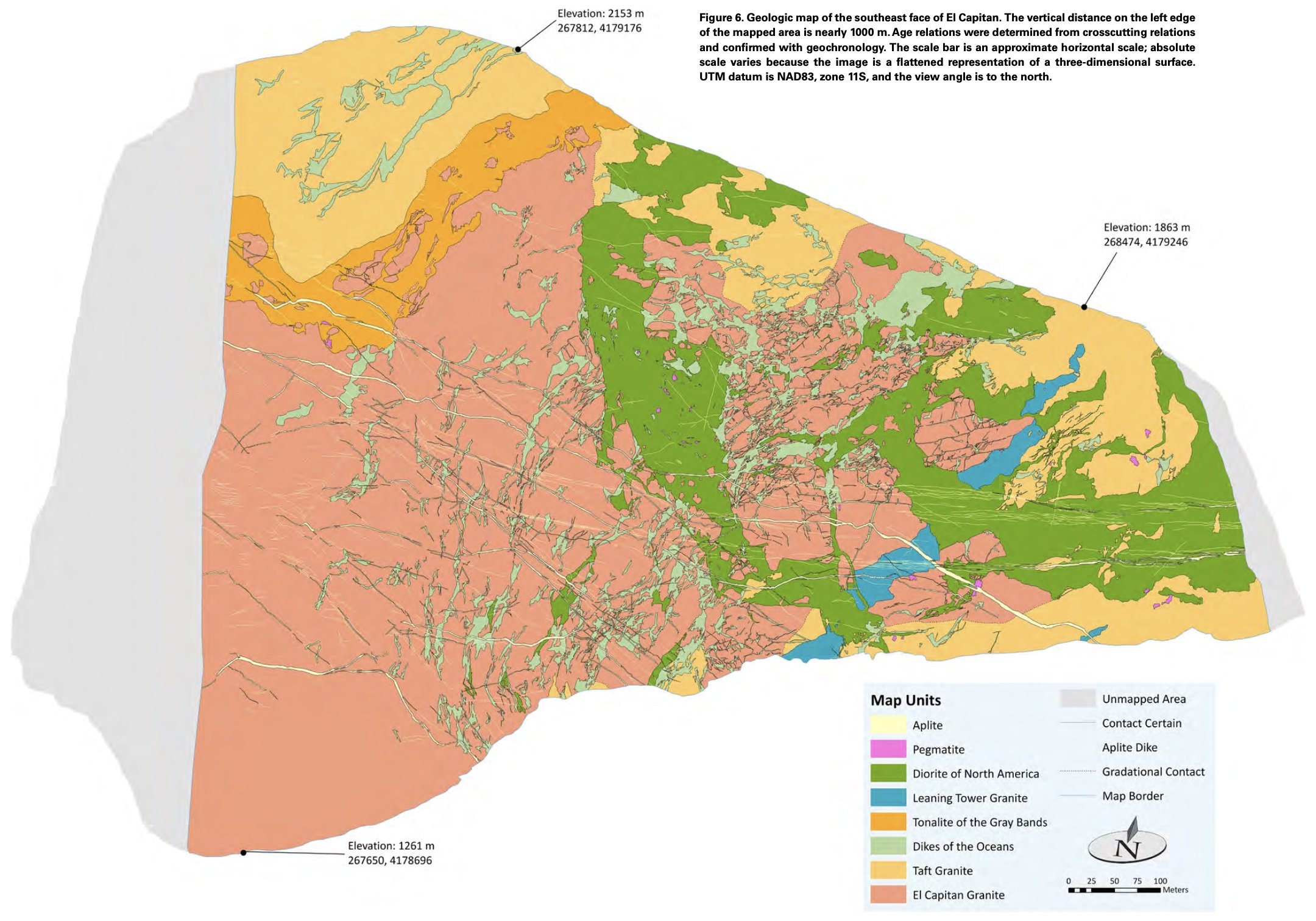
For his master’s thesis, Roger Putnam, an accomplished big-wall climber, did something unprecedented: he made an extremely detailed geologic map of the 1-km-tall southeast face of El Capitan (Putnam et al., 2015).
With support from the National Geographic Society, Roger climbed four complete routes and significant sections of several others, and crowd-sourced information about 15 other routes by enlisting other climbers to take rock photographs at belay stations. He then produced a map on a vertical base constructed of Gigapan images such as this one.
Click on the photo and see if you can find any climbers; the images have enough resolution to see climbing ropes. For GIS nerds, Roger’s map has about 500,000 nodes!
El Cap in GigaPan
You can read more about Yosemite’s Iconic El Capitan mapped in high-res 3D here.

