


New photo albums posted
I’ve posted a number of new photo albums. Here are a few samples.
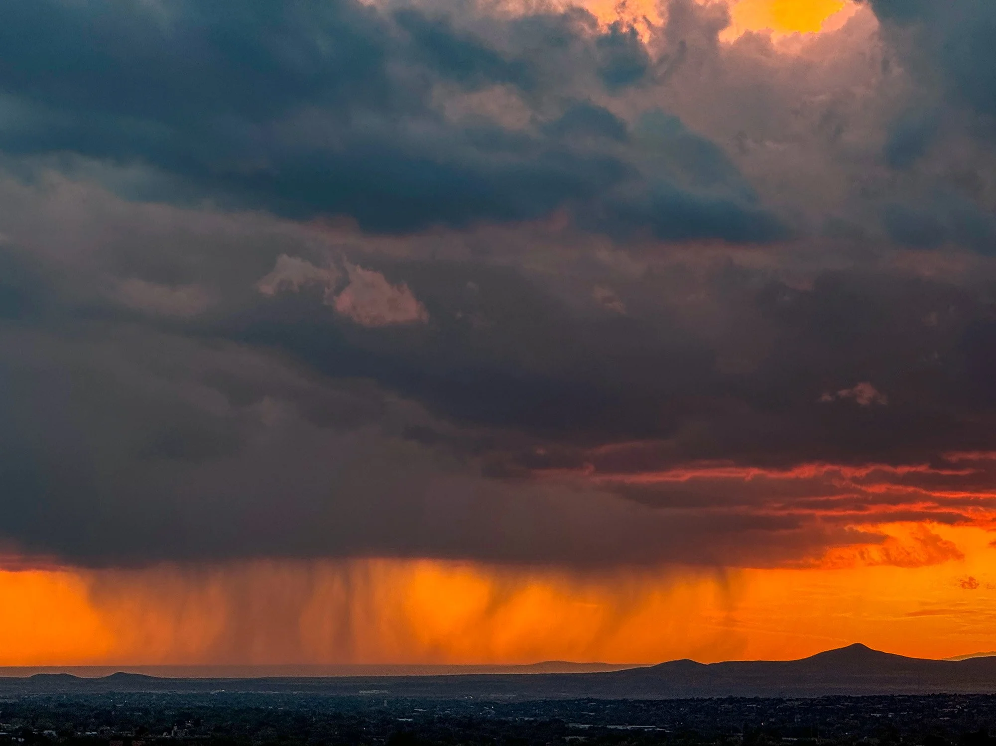
Clouds and weather


Yosemite overflight photos posted
Photos from a low-altitude (legal) research flight over Yosemite Valley and Tuolumne Meadows.
I’ve posted 47 photos from a June 2017 research flight over Yosemite Valley and Tuolumne Meadows here. This was part of a project, sponsored by National Geographic, to map the distribution of aplite dikes in Half Dome. I took 894 photos on the flight.
Patagonia photos posted
Photos from a two-week trip to Tierra del Fuego and Torres del Paine.
I’ve posted an album of photos from a trip to Patagonia on my Flickr site. We spent two weeks with guides from Kanaturaleza, about a week in Tierra del Fuego and 5 days in Torres del Paine. The pictures tell the story. A few are below.

Ice mushrooms on the summit of Paine Grande
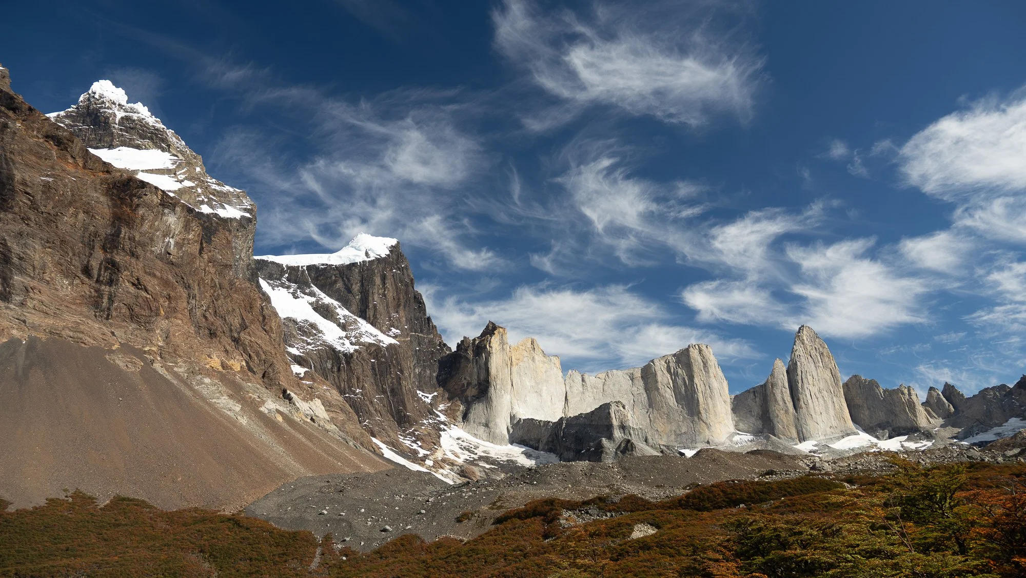
The view from Mirador Británico in Valle del Francés. We camped in the area and did a day hike to here. From left to right, Paine Grande, the North Summit of Paine Grande, Cerro Castillo, Cota Dos Mil, and Catedral.

Shark Fin and fall color

Puma attacking guanaco (the guanaco escaped)

Unnamed glacier, Parry Fjord, Cordillera Darwin

Cordillera Darwin and sphagnum bog with fall color, in morning light
Torres del Paine vs. Split Mountain — 3 — Comparison
Torres del Paine and Split Mountain share strong similarities, but the latter lies along the faulted eastern margin of the Sierra Nevada and was thus resistant to glaciation.
View to the west from Mirador Britanico, Torres del Paine National Park. Left to right, Paine Grande, North Summit of Paine Grande, Cerro Castillo, Cota Dos Mil, and Catedral. The North Summit-Cerro Castillo transition marks the steep margin of the granite laccolithic complex.

Aerial view of area south of Split Mountain and Cardinal Peak, including Mount Pinchot (left), Striped Mountain (center-right), and Goodale Mountain (right), from ~3000 m altitude. Here, the prominent granite is Cretaceous and overlies coeval layered diorites, as in Torres del Paine. Mount Pinchot and the dark rocks at right-center are a continuation of the metamorphic screen under Split Mountain, and the Cretaceous Striped pluton likely sits above this screen in a manner similar to the Tinemaha Granodiorite on Split Mountain. See Bartley et al. (2012) for details.
Cuernos del Paine in Torres del Paine National Park, Chile, and Split Mountain, Sierra Nevada, California, bear a great resemblance to one another. For example:
In both areas leucocratic granite (Miocene at Cuernos, Jurassic at Split) are roofed by dark brown metaclastic rocks (Cretaceous at Cuernos, Cambrian at Split) and these roofs are subhorizontal over several square km.
Both complexes are cut by numerous dikes (Miocene at Cuernos, Jurassic at Split).
Granites in both areas sent dikes and sills into the overlying metamorphic rocks, but…
…in neither area can one find blocks of the roof rocks in the granites. This is particularly well shown owing to the high color contrast between the dark metamorphic rocks and the light-colored granites.
So why did Torres del Paine develop km-tall cliffs and truly remarkable scenery, whereas Split Mountain is merely…well…a jagged 4300m peak bounded by km-tall cliffs…OK, Split Mountain is pretty spectacular, too, but it lacks the remarkable spires found at Torres (see top photo above). This difference is likely due, at least in part, to tectonic differences. Torres del Paine lies in a relatively quiet area, tectonically speaking, whereas Split Mountain lies along the Sierran crest and is bounded on the east by the extensional frontal fault system of the range. Rocks east of the crest have been pulverized by faulting, and this is evident in the intense vertical jointing in the leucogranite. By contrast, faulting at Torres is minor, and the rocks have widely dispersed joints.
Torres del Paine vs. Split Mountain — 2 — Split Mountain
Split Mountain in California bears a strong resemblance to Torres del Paine. It is also much more accessible.
Before comparing Split Mountain to Torres del Paine, a bit about Split Mountain itself. Split (4287 m, 14,064’) is a well-known “fourteener” in California—a peak over 14,000’ (4267 m) tall. It is a dominant peak along the stretch of the Sierra Nevada south of Bishop and lies south of the Palisades group of fourteeners. John Bartley, Kevin Mahan, and I described the geology of the Split Mountain area in a 2012 paper in Geosphere:
There are four main units in the area:
Metamorphosed sandstones, shales, and limestones from a late Proterozoic and Cambrian marine shelf sequence; these are correlative with the Cambrian Campito and Poleta Formations;
Jurassic leucogranite of the Red Mountain Creek pluton;
Dark gray Tinemaha Granodiorite, dated at 165 Ma; and
Dikes of the ~150 Ma Independence dike swarm, which cut all the units above.
To geologists of a certain age Split Mountain was made famous by the magnificent 1966 book Geology Illustrated by John Shelton. This book was essentially an introductory geology book centered around aerial photos that Shelton, a pilot, had taken.

Title page of Geology Illustrated
Shelton used his photo of Split Mountain to illustrate the concept of a “roof pendant”, a place where the roof of a great batholithic cauldron sagged down into the magma below. Regardless of the merits of the term, it is also a great photo of a pluton roof, and more subtly, of a pluton floor.

Shelton’s photo of Split Mountain, looking northwest over Mather Pass and Palisade Creek. This photo must have been taken from an altitude of 16,000’ or more.
Split Mountain is easily viewed from Highway 395 about 20 km south of the town of Big Pine. In morning light, the granite, overlying brown metamorphic rocks, and dark gray granodiorite that overlies everything are clearly visible.

Sierran range front, looking west in morning light, from Highway 395 south of the Poverty Hills. White leucogranite is overlain by dark brown metasedimentary rocks that are in turn overlain on Split Mountain by dark gray granodiorite. It’s a twofer—a pluton roof and a pluton floor in one photo. Split Mountain is the large peak on the right with its characteristic V notch, and the minor peak on the left, at the end of a long aréte composed of metasedimentary rocks, is Cardinal Peak.
Aerial photos of show the relationships of the plutonic rocks to their wall rocks in detail. I piloted a Cessna 152 past this area several times, and up to the cliff faces once. It took the better part of an hour to get the Cessna up to about 12,000’. The following air photos were taken by both me and by John Bartley, who was the passenger. The stall warning horn was going off intermittently the whole time, which only added to the excitement (we were safe, with several thousand feet of air beneath us).

Panorama of the aréte running from Cardinal Peak (left) north toward Split Mountain. Highly jointed and locally iron-stained leucogranite is overlain by brown metasandstone correlative with the Cambrian Campito Formation, with a bit of greenish Cambrian Poleta Formation atop Cardinal Peak.
Cardinal Peak. Abundant NW-striking dikes are evident in the leucogranite, but these cut the brown metamorphic rocks as well. The cirque on the right is occupied by rock glaciers.

Closeup of the Cardinal-Split aréte. Layering in the metasedimentary rocks is subparallel to the roof contact, and dikes of granite cut these roof rocks. Here and elsewhere there is no sign of any blocks of the roof rocks within the granite.
Here is a ground-based photo of the back side of this aréte, where Cardinal Lake lies:

Late-afternoon light on the east side of the Cardinal-Split aréte. Abundant mafic and intermediate dikes of the Independence swarm cut both the leucogranite and the capping metamorphic rocks. Summit of Cardinal Peak, with its cap of Poleta Formation, at left.
Although Split Mountain is best known as an illustration of a pluton roof, a pluton floor is clearly visible on the peak itself. The metamorphic rocks are squeezed between leucogranite below and mafic granodiorite above, and this relationship extends over several square km.

Aerial view of Split Mountain from ~4000 m altitude, looking northwest. Leucogranite, locally stained deep orange, underlies dark brown metaclastic and buff metacarbonate rocks. These are in turn overlain by dark gray Jurassic Tinemaha Granodiorite. In Shelton’s black-and-white photograph the metamorphic rocks and granodiorite are barely distinguishable. Nevertheless, this is an excellent example of a flat-lying pluton floor that extends over several square km in this area (Bartley et al., 2012). Intermediate and mafic dikes cut through all the units. These are locally up to 10 m thick, and are highly composite.
Next: comparison of the two areas.

Torres del Paine vs. Split Mountain — 1 — Cuernos del Paine
Remarkable similarities between the iconic granite complex in Torres del Paine National Park, Chile, and Split Mountain in eastern California.
I spent the second half of March in Patagonia with three other geologists. We were in the care of the small guide company Kanaturaleza and spent the first week in Tierra del Fuego and the second in Torres del Paine. This was my second time to Torres del Paine, and this time we were able to hike up into Valle del Francés for spectacular views of the Miocene granite and Cretaceous metasedimentary rocks. We were accompanied by guides Nacho and Sofia from Kanaturaleza.

Cuernos del Paine (Horns of Paine) from Rio Serrano. Miocene granite is capped by dark-brown, folded meta-turbidites of Cretaceous age.
The contact between the light yellow to light gray granite and the dark brown metasedimentary rocks is strikingly sharp from a distance, and strikingly sharp from a closer vantage point. Here is a closer view from Paine Grande camp on Lago Pehoé.

The contact between the granite and its metasedimentary roof is knife-sharp; the metamorphic rocks provide the horns of Cuernos del Paine.
We spent two nights at Camp Francés and spent the intervening day hiking up Valle del Francés to Mirador Británico. The weather was spectacular; light winds most of the time, a high around 65F (18C), and just enough cloud cover to make photos even more spectacular. Here are some sights that we saw on the way up the valley.

Paine Grande (metamorphic rocks) in morning light.
Granite dikes and sills in Cuerno Principal. Note subhorizontal granite dikes in the roof rocks and thin en echelon mafic dike that cuts the granite.

Trace fossils (burrows) in steeply tilted turbidites, Mirador Francés. These beautiful trace fossils are right on the trail at Mirador Francés.
Cuerno Norte (L), Cuerno Principal (R), with Miocene granite overlain by Cretaceous metasedimentary rocks.

Sheeting in granite at Cuerno Norte: another angle showing what appear to be thick sheets in the underlying granite.

Granite roof at Cuerno Norte. Both the granite and overlying metasedimentary rocks are cut by intermediate(?) dikes.
I have posted lots of pictures from our Patagonia trip on my Flickr site, including many more from Torres del Paine.
Being a granite petrologist, getting in to see this stuff up close was a dream for me. But what I found truly striking was just how much the Torres del Paine granite complex resembles the geology at Split Mountain in eastern California (note: there are three Split Mountains in California; this is the one on the crest of the Sierra Nevada between the towns of Lone Pine and Bishop).

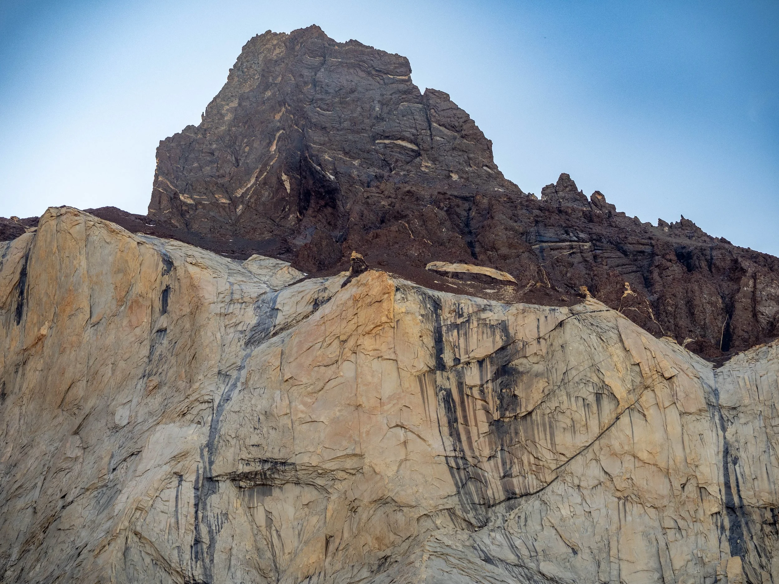
Cardinal Peak and the arête to Split Mountain, Sierra Nevada, California. Dark brown Cambrian metasandstones (Campito Formation) sit on Jurassic leucogranite. The greenish summit cap of Cardinal Peak comprises metacarbonates and calc-silicates derived from the Cambrian Poleta Formation.
I will talk about Split Mountain in the next post.
Announcing “Petrology and Plate Tectonics: An Earth Systems Approach” by Glazner & Kohn
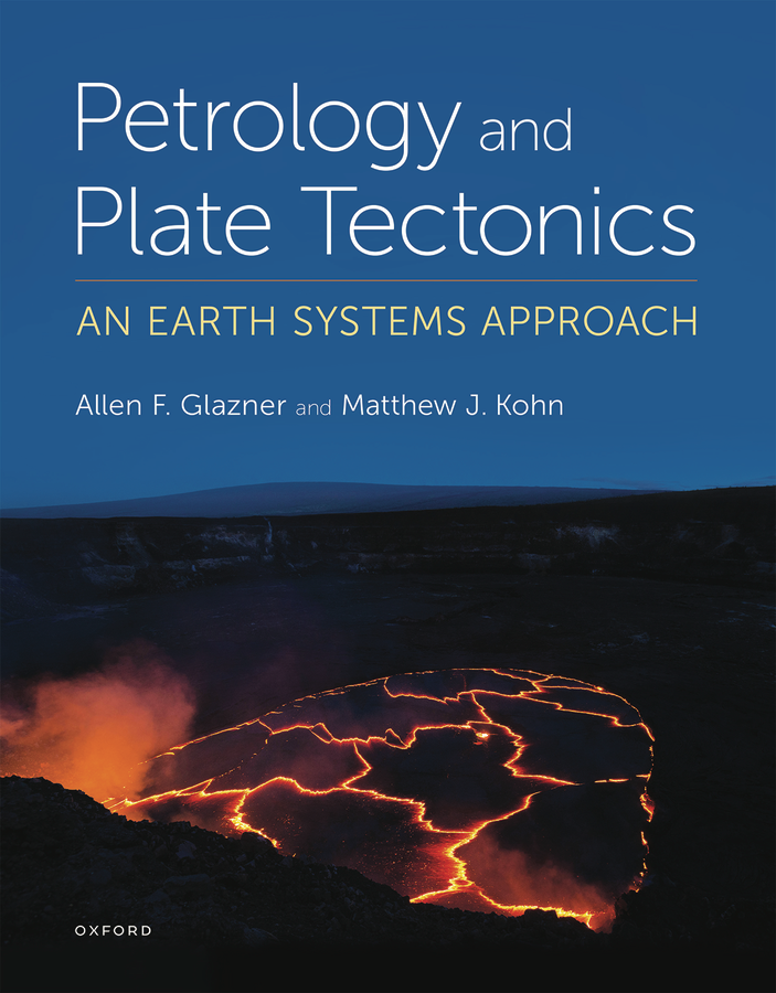
Cover of Petrology and Plate Tectonics: An Earth Systems Approach by Glazner & Kohn
Matt Kohn and I are happy to announce that our book is scheduled to be available from Oxford University Press for the spring semester. Read on if you are interested in a new way to teach about the solid Earth.
Summary
Petrology and Plate Tectonics: An Earth Systems Approach offers a new way to teach igneous and metamorphic petrology to undergraduate Earth Science majors. It discards the ubiquitous “Part I: Igneous, Part II: Metamorphic” organization and instead presents petrology from an earth systems viewpoint, using plate tectonics as its unifying theme, making recurrent use of geochronology and isotope geochemistry to solve petrologic problems, and emphasizing links among the deep Earth, lithosphere, hydrosphere, and atmosphere.
As an example of this new structure, after discussing generation of basalt at mid-ocean ridges we dive into metamorphic reactions that hydrate oceanic crust and mantle. For subduction zones, we present origins of high-P/low-T rocks first, then discuss magma generation. Discussion of plutonism is followed by a chapter on contact metamorphism, hydrothermal systems, and thermochronology.
Other points:
We use an inductive approach, motivating study of a topic (e.g., phase equilibria or the Sr isotope system) as a way to solve problems, rather than the standard deductive approach in which early chapters are devoted to a survey of principles, which may or may not be used in later chapters.
Key isotope systems, particularly Sr and O, are used repeatedly to solve problems ranging from dating geologic events to determining the source of geothermal waters in Iceland.
Links between petrology and other disciplines and pursuits (e.g., paleoclimatology, archaeology, economic geology, materials science, life in extreme environments, rock climbing, art and literature) are highlighted in Making Connections boxes.
Classification is deemphasized.
Table of Contents
Chapter 1 Plate Tectonics and Petrology
1.1 Distribution of Volcanoes, Earthquakes, and Topography on Earth
1.2 The Range of Magmatism on Earth: The Basalt-Rhyolite Spectrum
1.3 Earth Systems and Holistic Petrology
1.4 Petrology and Tectonic Setting
1.5 The Terminology of Petrology
1.6 Lithosystems
1.7 A Final Note
Chapter 2 Raw Materials: Formation of the Earth
2.1 Formation of the Solar System and Earth
2.2 Meteorites
2.3 Age of the Earth
2.4 Sources of Heat
2.5 Supernovas, Kilonovas, and the Elements
2.6 Gross Structure of the Earth
2.7 Temperature and Pressure in the Earth
2.8 The Lithosphere
2.9 The Earth Then and Now
Connections: Where Does Lithium Come From?
Connections: Earth's Thermostat: The Carbonate-Silicate Cycle
Chapter 3 Mid-Ocean Ridges and Production of Oceanic Crust
3.1 The Mid-Ocean Ridge Network
3.2 Ophiolites and the Seismic Structure of Oceanic Crust
3.3 Melting and Generation of Magma
3.4 Thermodynamics of Melting and Other Phase Transitions
3.5 Melting Peridotite
3.6 Chemographic Diagrams and Mass Balance
3.7 Upwelling and Melting
3.8 Sr-Isotope Geochemistry of Oceanic Ridges
Connections: Serpentine Soils
Chapter 4 How Rocks Melt and How Melts Crystallize
4.1 Eutectic Melting: Forsterite-Diopside as a Model of the Mantle
4.2 Olivine and Orthopyroxene: Peritectic Melting
4.3 Crystal Fractionation
4.4 Olivine-Orthopyroxene-Clinopyroxene: The Ternary System
4.5 What Controls the Composition of the First Liquid Produced?
4.6 Types of Basalt: The Basalt Tetrahedron
4.7 Forsterite-Diopside-Quartz at Higher Pressure
4.8 Iron and Reality: The Olivine System
4.9 The AFM Diagram and Calc-Alkaline Trend
Connections: The Steel Phase Diagram
Chapter 5 Metamorphism and Hydration of Oceanic Lithosphere
5.1 The Earth’s Deep Water Cycle
5.2 Hydrothermal Systems at Mid-Ocean Ridges
5.3 Metamorphic Facies
5.4 Geochemical Evidence for the Source of Water in Hydrothermal Systems
5.5 Massive Sulfide Deposits
5.6 The Next 100 Million Years or So
Connections: Asbestos
Connections: Hydrothermal Systems, Serpentine, and Deep Life
Chapter 6 Subduction and the Formation of Blueschists and Magmas
6.1 Subduction Zones
6.2 Lithosystems Associated with Subduction Zones
6.3 The Nature of Subduction and Plate-Driving Forces
6.4 Anatomy of Subduction Zones
6.5 Thermal Structure of Subduction Zones
6.6 Melting in the Presence of Water
6.7 Generation of Magma in Subduction Zones
Connections: Porphyry Copper Deposits
Chapter 7 Volcanism and the Spectrum of Igneous Activity on Earth
7.1 The Spectrum of Volcanic Activity
7.2 Volcanic Explosivity Index
7.3 Physical Properties of Magma
7.4 Products of Volcanoes
7.5 Magma Transport in the Crust
7.6 A Survey of Volcanic Styles and Landforms
7.7 Links between Volcanism and Climate
Connections: Volcanism, Art, and Literature
Connections: Silicic Supereruptions and Ecosystems
Chapter 8 Origins of Magmatic Diversity
8.1 Crystal-Liquid Separation During Crystallization
8.2 Magma Mixing, Assimilation, Partial Melting, and Other Processes
8.3 Generation and Crystallization of Silicic Magma
Connections: Popsicles: A Sweet Example of Partial Melting
Chapter 9 Tools for Probing Magma Origin and Evolution
9.1 Trace Elements
9.2 Principles of Trace Element Variation
9.3 Trace Elements and Tectonic Setting
9.4 Isotopes and Petrogenesis
9.4 Mass Balance And The Crustal Paradox
9.5 “Evolution” in Igneous Systems
Connections: Obsidian Sourcing and Trade Routes
Chapter 10 Plutons and How They Form
10.1 Plutons, Batholiths, and Intrusive Suites
10.2 Field Aspects of Plutonic Rocks
10.3 Origin and Evolution of Granitic Magma
10.4 Magma Ascent and Arrest
10.5 Modes of Magma Ascent
10.6 The Room Problem
10.7 Incremental Emplacement
10.8 Annealing and Recrystallization in Plutons
10.9 Relationships Between Plutonic and Volcanic Rocks
Connections: Rock Climbing
Connections: Countertop Granites
Chapter 11 Contact Metamorphism, Hydrothermal Systems, and Thermochronology
11.1 Contact Metamorphism
11.2 Thermal Evolution of Pluton Aureoles
11.3 Isograds and the Metamorphic Evolution of Pluton Aureoles
11.4 Incremental Emplacement of Large Plutons
11.5 Skarns: Reaction Between Magma and Wall Rocks
11.6 Hydrothermal Systems Around Intrusions
11.7 Thermochronology and the Meaning of Isotopically Determined Ages
Connections: Cement Production and Anthropogenic CO2
Connections: Hydrothermal Systems and DNA Sequencing
Chapter 12 Making Continents: Continental Collision, Accretion, and Regional Metamorphism
12.1 Plate Motions, Orogens, and Metamorphism
12.2 Continental Geotherms
12.3 P-T Predictions from Thermal Models
12.4 Metamorphic Reactions
12.5 Mineral Assemblage Diagrams
12.6 Petrochronology and Fabrics: Putting Time on the P-T Path
12.7 Igneous Activity in Collisional Orogens
Connections: Collisions and Climate
Chapter 13 Continental Rifting and Magmatism
13.1 Continental Rifts
13.2 Fault Styles and Magma Emplacement in Continental Rifting
13.3 Rifting and Melting
13.4 Subcontinental Lithospheric Mantle
13.5 Mantle Samples Brought Up by Alkaline Rocks
13.6 Alkaline Magmatism
13.7 Controls on the Compositions of Alkaline Magmas
13.8 Metamorphic Rocks in Extensional Terranes
Connections: Hominids and the East African Rift Valley
Connections: Shaken, Not Stirred--Limnic Eruptions and Their Fatal Consequences
Chapter 14 Intraplate Magmatism, Hotspots, and Large Igneous Provinces
14.1 Hotspots and Their Tracks
14.2 Mantle Plumes
14.3 Mantle Reservoirs
14.4 Large Igneous Provinces (LIPs)
14.5 Layered Mafic Intrusions
14.6 Impacts
Connections: Ocean Island Basalts and Polynesian Migrations
Connections: Siberian Traps and the End-Permian Extinction
Chapter 15 What's Next?
15.1 Whence Petrology?
15.2 Some Outstanding Problems in Petrology and Plate Tectonics
15.3 Epilogue

Going to the Grand Canyon
April 27, 2024
I’m headed to the Grand Canyon in May to go on a rafting trip led by Wayne Ranney for Colorado River & Trail Expeditions, and then to help lead a National Geographic trip to Grand Canyon, Bryce Canyon, and Zion National Parks. As my memory for stratigraphic sections has never been all that good, I’ve prepared simplified a stratigraphic column for Grand Canyon National Park and another for the region of Utah surrounding Bryce Canyon and Zion National Parks. These have been taken from a number of great sources that are cited on the figures.
I hope others find these useful when visiting the areas. Download the columns from this page.


Badwater Road is Really Screwed Up
When Death Valley experiences bad weather, Badwater Road gets hammered by floods caused by the diversion of Furnace Creek Wash—a fully predictable problem
August 13, 2022
Badwater Road runs south from Furnace Creek and provides access to some of the most iconic spots in Death Valley National Park, including Badwater, Artists Drive, Natural Bridge Canyon, and Devils Golf Course. The road, narrow two-lane blacktop, runs south from Highway 190 at the mouth of Furnace Creek Wash, hugging the faulted western base of the Black Mountains for a few miles before running in straight stretches across alluvial fans. Approaching Badwater the road is forced back to the steep mountain front to avoid crossing the muddy salt flats.

Badwater Road heading south across alluvial fans toward Artists Drive and Ventifact Ridge
Diversion of Furnace Creek Wash down Gower Gulch 80 years ago has caused a lot of grief for the people who maintain the Park’s roads. Before the diversion, Gower Gulch, like better-known Golden Canyon half a mile to its north, drained a small (two square mile) area of soft sedimentary and minor volcanic rocks in the northern Black Mountains. It has been slowly eating eastward, and before the artificial diversion there was only a low drainage divide of soft siltstone separating it from Furnace Creek Wash. That system drains an area about 100 times larger than that drained by Gower Gulch, and carries much larger and harder rocks derived from the Funeral Mountains.
The consequences of sending floods from Furnace Creek down poor little Gower Gulch were predictable and dramatic. Gower had built a small alluvial fan of relatively fine-grained sand, pebbles, and cobbles at its faulted mouth, and the system was reasonably stable and content. Heavy rains would send small debris flows down the little fan, but these typically spread out and dissipated before reaching Badwater Road. The first post-diversion floods from Furnace Creek, however, deranged the system. They were much larger than pre-diversion floods and far more erosive owing to the much greater volume of water and the much larger and harder tools (rocks) that they carried. They quickly carved a deep trench into the head of the old fan, and this trench confined subsequent flows, allowing them to flow farther down the fan.

Badwater Road at Gower Gulch looking north toward Golden Canyon and Furnace Creek. This part of the road is typically buried by flood debris washed down Gower Gulch during storms, and the bulldozed material on the left is debris from the last time the road was cleared.
About a quarter-mile from the range front, shortly before reaching the road, the new channel has been depositing material rather than eroding into the old fan. Every significant storm deposits debris on the road and rips up asphalt, which has been reinforced by various means over the years. The road is essentially being periodically buried under a new, larger fan that really wants to bury the road for good.

Flood debris from Gower Gulch across Badwater Road in 2017. Photo courtesy of Garry Hayes, geotripper.blogspot.com
If anyone has a good idea on how to fix this, tell the Park Service.
Parking along Badwater Road and walking up to the range front is an easy walk and an interesting lesson in geology. Within 100 yards of the road the channel that has carried the road-burying material down the gulch becomes incised—just a few feet at first, but rising to fully 20 feet at the mouth of the canyon. The material exposed in the vertical walls of the eroded fan is relatively fine-grained, locally derived material from the local drainage—clasts of sedimentary and volcanic rocks of the Furnace Creek Formation. The stuff in the bottom of the wash is quite different—much larger clasts of limestone, dolostone, and other rock types that are exotic to the local area and were carried in from the Funeral Range by Furnace Creek Wash.

OK, this may not be a spectacular photo, but it tells an interesting story. The vertical wall, carved in the old, pre-diversion fan, consists of young volcanic and sedimentary material from Gower Gulch proper. The much larger rocks littering the bottom of the active wash are exotic to the area and were carried down Furnace Creek Wash and then down little Gower Gulch. The larger floods that carried them were quite effective at cutting down into the old, soft fan. Twenty feet and counting.
You don’t have to look very hard to find even more exotic material—asphalt from Highway 190, which is periodically ripped up at the diversion site by headward erosion of the newly emboldened Gower Gulch.
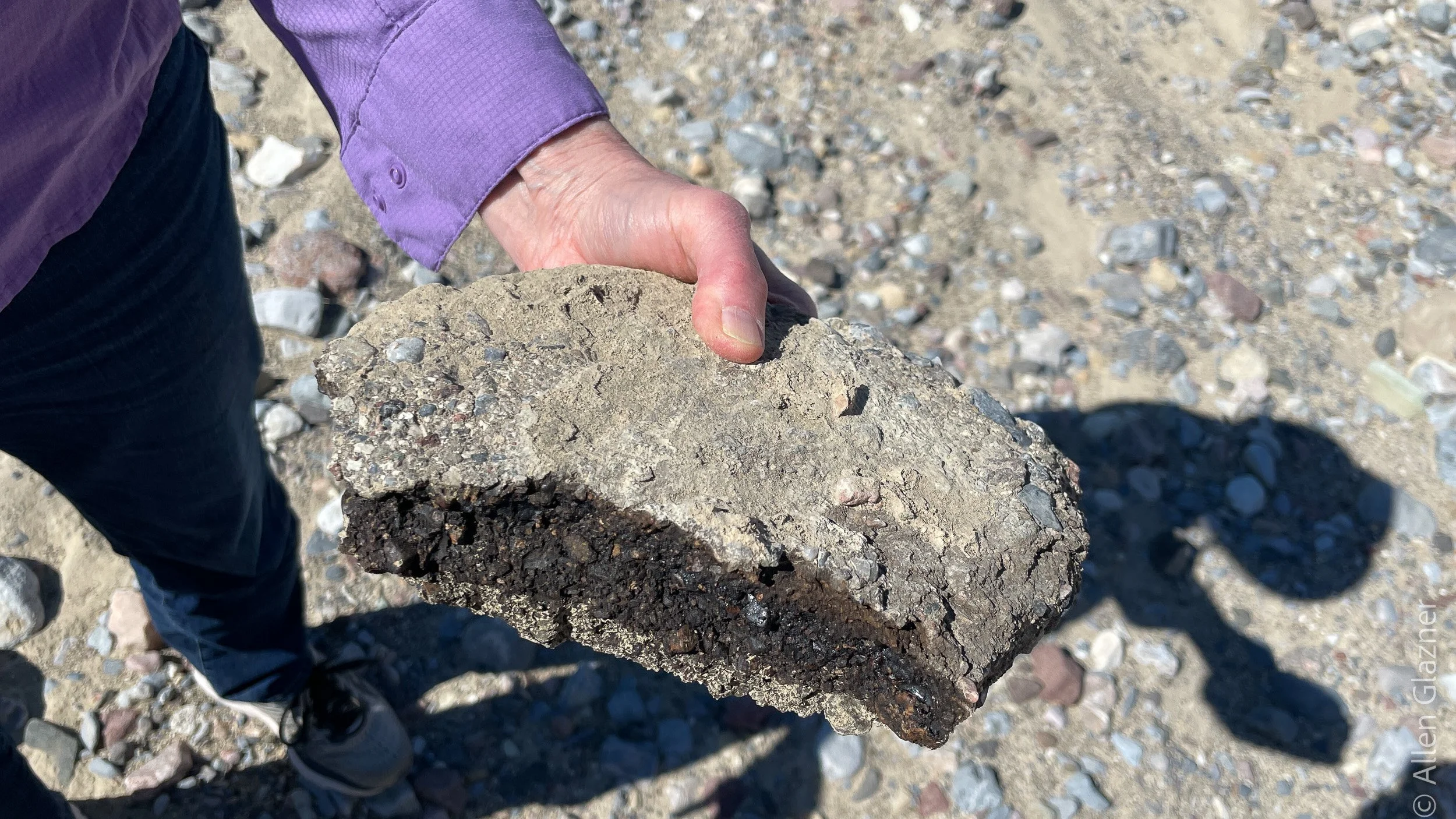
Yep, that’s asphalt.
I have not yet seen what damage the floods of earlier this month have done to Badwater Road, but it is likely to be significant.
Death Valley Flooding 2022: The Futile Diversion Attempt at Gower Gulch
Eighty years ago a bulldozer and a little dynamite were used to divert Furnace Creek into little Gower Gulch. Did it work?
August 7, 2022
Furnace Creek Wash drains a big area—440 square kilometers, an area about equal to that of Lake Tahoe. The wash is dry most of the time, but cloudburst storms can change that in a hurry and chew up buildings, roads, and other infrastructure at the mouth of the canyon, where Furnace Creek Inn sits.

Service station in the wash at the mouth of Furnace Creek, 1935. Not a good place to put gas pumps and storage tanks. Photo from the Los Angeles Times.
Eighty or so years ago a mining company decided to fix the problem by erecting a berm across the wash and diverting stream flow into the head of Gower Gulch, which at that time drained an area about 100 times smaller.
It is doubtful that the mining company obtained any permits for this work. This was back when you could drive up Natural Bridge Canyon and to the Zabriskie Point viewpoint, and when the Park Service would routinely dynamite the salt crust at Devil’s Golf Course to keep the salt pools open for tourist view.

The berm is visible in a 1948 U.S. Geological Survey aerial photograph. Here’s the full frame:
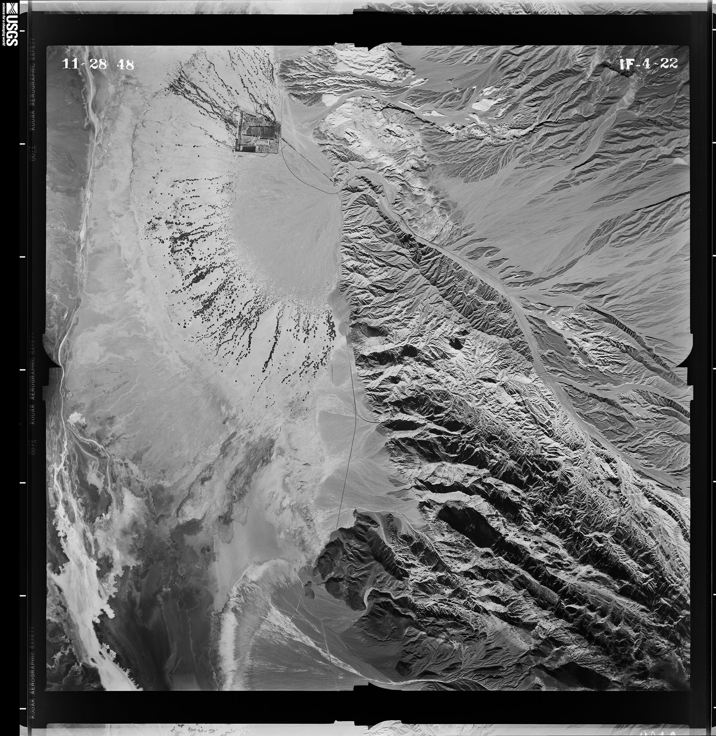
1948 aerial photo of Furnace Creek Wash. The main wash comes in from the lower right (southeast), heads northwest, makes a hard left turn, and then debouches (a good geology word) onto the beautiful cone of the Furnace Creek alluvial fan. The square block of development on the north side of the fan is Furnace Creek Ranch. Furnace Creek Inn is at the head of the fan, too small to resolve at this scale.
Here is a closeup of the Zabriskie Point area, where the bulldozed berm is easy to see 7 or 8 years after it was built:
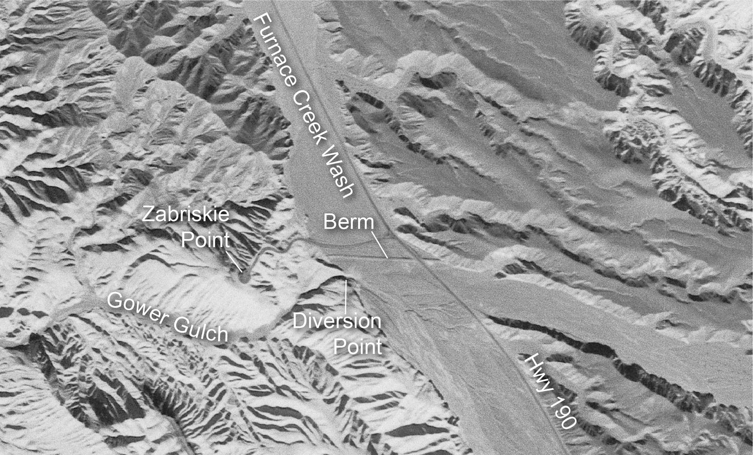
The berm was just south of the road up to Zabriskie Point. There is no trace of it left now owing to road grading and flooding. The current parking area (which may have been ripped up in this month’s floods) covers most of where it was. Note the small streams that had already formed across Furnace Creek Wash just south of the berm, heading for the newly blasted cut into Gower Gulch.
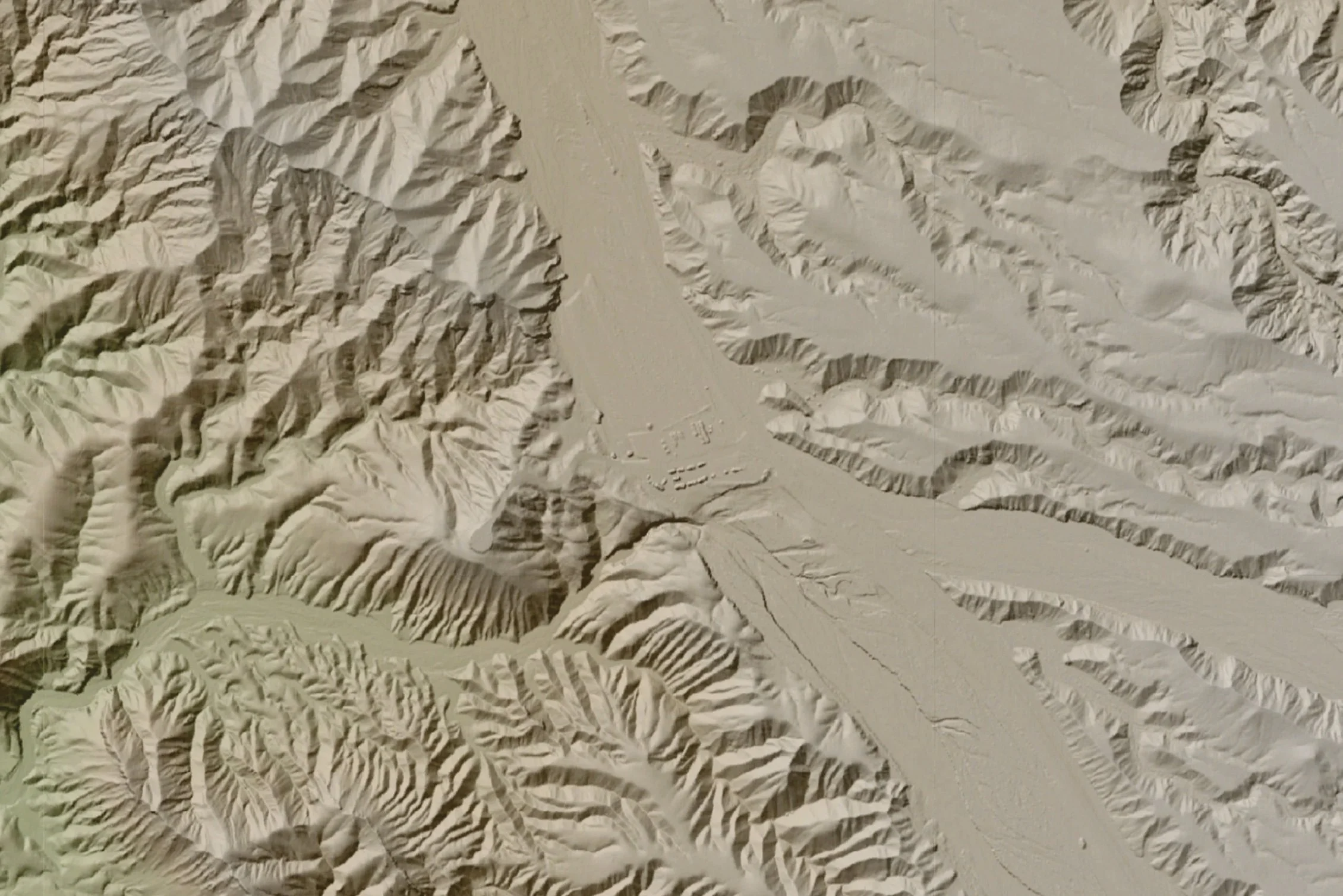
In 2005 NCALM flew a LIDAR survey of this area under a grant obtained by Noah Snyder of Boston College. Here is the same area. Note how much more erosion there has been at and upstream (southeast) of the diversion point.

Lidar image of the Gower Gulch area. Note how much entrenchment there has been and how the gulch is eating eastward and into the highway, aided by floods coming down the large unnamed side wash that enters from the right (east). Data source: Furnace Creek Wash, Death Valley National Park, California. Distributed by OpenTopography. https://doi.org/10.5069/G9P848VX . Accessed: 2022-08-07
The view east from up by the Zabriskie Point overlook is interesting. Here are two: one shot in 1973 by Bob Norris, and the other in 2017. The deep shadowed cleft at right is uppermost Gower Gulch, where floods send some—but not all—of their water.
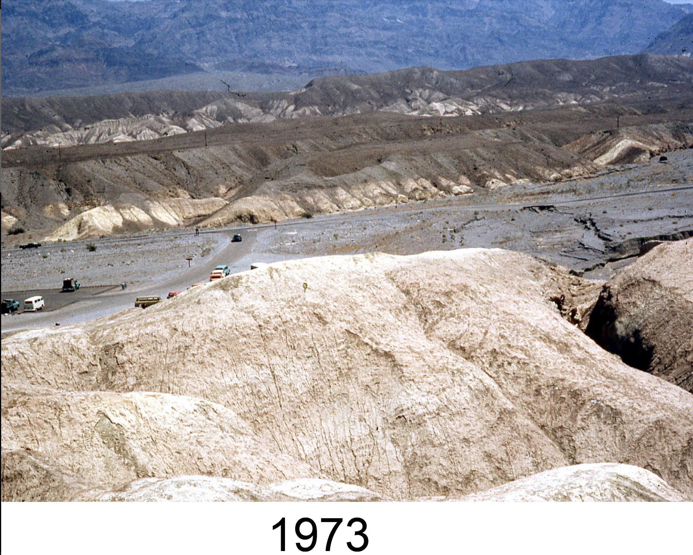
Looking east from Zabriskie Point toward Highway 190 in 1973. Headward erosion of Gower Gulch has started to eat into the highway, which is built in the wash.

The same view in 2017. There has been much more dissection of the wash, and eastward erosion has cut into the highway. Repair trucks for scale. By this time, the wash upstream of the diversion had been excavated about 20 feet deep.
For more information about Gower Gulch, see Geology Underfoot in Death Valley and Eastern California.

Death Valley Flooding 2022: Trying to Tame Furnace Creek Wash
The mouth of Furnace Creek Wash has a beautiful view, but it is a terrible place to build stuff, especially when it rains.
August 6, 2022

Furnace Creek Inn sits at the mouth of Furnace Creek Wash, which curves sharply upon approach. The parking lot and other infrastructure sit squarely in the path of floodwaters.
Furnace Creek Inn (or whatever it’s called these days) was built nearly 100 years ago at the mouth of Furnace Creek Wash, at the apex of the huge Furnace Creek alluvial fan. Although the main facilities lie comfortably above the level of the wash, the parking lot and other infrastructure, including at one time a gas station, were built on the normally dry wash bed.
I visited the area and took pictures in March 2022 in preparation for a talk given later that month by Art Sylvester at the Geological Society of America Meeting in Las Vegas. The talk was about the effects of an artificial diversion of Furnace Creek, made 80 years earlier with a bulldozer and a little bit of dynamite, upstream at Gower Gulch. The diversion was intended to protect the Inn and other structures at the mouth of the wash from floods, but it failed miserably and introduced a number of other problems upstream near Zabriskie Point.

Dropping down Furnace Creek Wash toward the Inn, motorists are advised to slow down to make the sharp left turn. The wash makes a similar sharp turn, but floodwaters and debris flows ignore the sign and only turn once they run into stuff on the right side.
The monsoonal floods of August 2022 showed how ineffective the diversion was. As of today (6 Aug 2022) reports of damage are sketchy, but I did see a photo of 50 or more vehicles in the Inn’s parking lot buried to their axles by debris flows that coursed down the wash.

A low bulldozed berm built to protect housing and parking at the Furnace Creek Inn had already been partially chewed into in March. The recent floods likely overran and washed away this berm, because cars in the parking lot behind it were partially buried by flood debris.
For a thorough discussion of the effects of the diversion at Gower Gulch, see Geology Underfoot in Death Valley and Eastern California. More about that later, and I hope to see the effects of the recent floods myself in September.

Best Geology in the World
Eastern California has the best geology in the world. If anyone wants to argue this point, go ahead, but you’ll lose. Why do I make this assertion? Check it out:
✔ Volcanoes?
✔ Earthquakes?
✔ Glaciers?
✔ Hot springs?
✔ Alpine granite peaks?
✔ Mountains of upside-down rocks?
✔ Folds, faults, unconformities, and other geologic features that look like they were made for textbook display?
✔ Extreme topography? The topography is so extreme that the highest point in the lower 48 states and the lowest point in North America are in the same county.
✔ Supereruptions?
✔ Evidence of rapid, extreme climate change that wasn’t our fault?
✔ Evidence that the Earth was almost entirely iced over in the distant past?
The area is bordered by three national parks (Yosemite, Death Valley, and Kings Canyon) and could easily support the designation of several more. There are enough roads, but not too many. Plenty of campgrounds and trailheads. Development has been sparse due to land use restrictions, so you can drive long stretches of Owens Valley, with the mountains rising 10,000 feet on either side, and not see a building or a billboard.
Hordes of people visit eastern California to climb, hike, fish, backpack, camp, ski, and enjoy the spectacular scenery. All this scenery, water, snow, rocky trails, cliffs, boulders, and so on are products of geology. This is part of the region known as the Basin and Range, and without plate tectonics and the forces that are rifting the area apart, there would be no basins or ranges. Without the Sierra Nevada trapping moisture from storms, California would be a drier place but, perversely, Death Valley would be wetter. And there would be no mountain scenery.
If you want to learn about the geology underlying this magnificent part of the world, pick up a copy of Geology Underfoot in Death Valley and Eastern California. It comprises 33 copiously illustrated vignettes that each tell a geologic story or two about a particular place. The emphasis is to get you out of your vehicle and get the geology under your feet.
Vignettes cover topics including Badwater, the lowest place in North America (-282 feet); Dantes View (sorry, the Board of Geographic Names doesn’t like apostrophes), where you can see Badwater and 14,000-foot peaks in the Sierra Nevada in the same view; the Racetrack,, the mysterious dry lake where rocks move across the mud; Fossil Falls, a dry double fall carved by the glacial Owens River; the magnificent scarp of the 1872 Lone Pine earthquake, a temblor as large as the 1906 San Francisco earthquake; and Devils Postpile, a thick lava flow whose glaciated top reveals a beautiful mosaic of 5-, 6-, and 7-sided columns.

Geology Underfoot in Death Valley and Eastern California is available at bookstores, visitor centers, and other outlets in eastern California, including Spellbinder Books and Eastside Sports in Bishop. If you can’t support local, you can order it online.
15 May 2022

Civilization and its Geologic Consents
Civilization is a shaky concept.
“Civilization exists by geological consent, subject to change without notice” according to Ladies’ Home Journal.
Author, historian and philosopher Will Durant penned those memorable words, immortalized on a UNC Geology Club t-shirt and pictured in the January 1946 issue of the above-mentioned periodical. In between advertisements for Brillo Pads, Hex mothproofing liquid, and Excello kitchen towels, he laid out the many ways that civilization can be whacked upside the head by geologic events, including earthquakes, ice ages, warming climate, drought, or excessive rain.
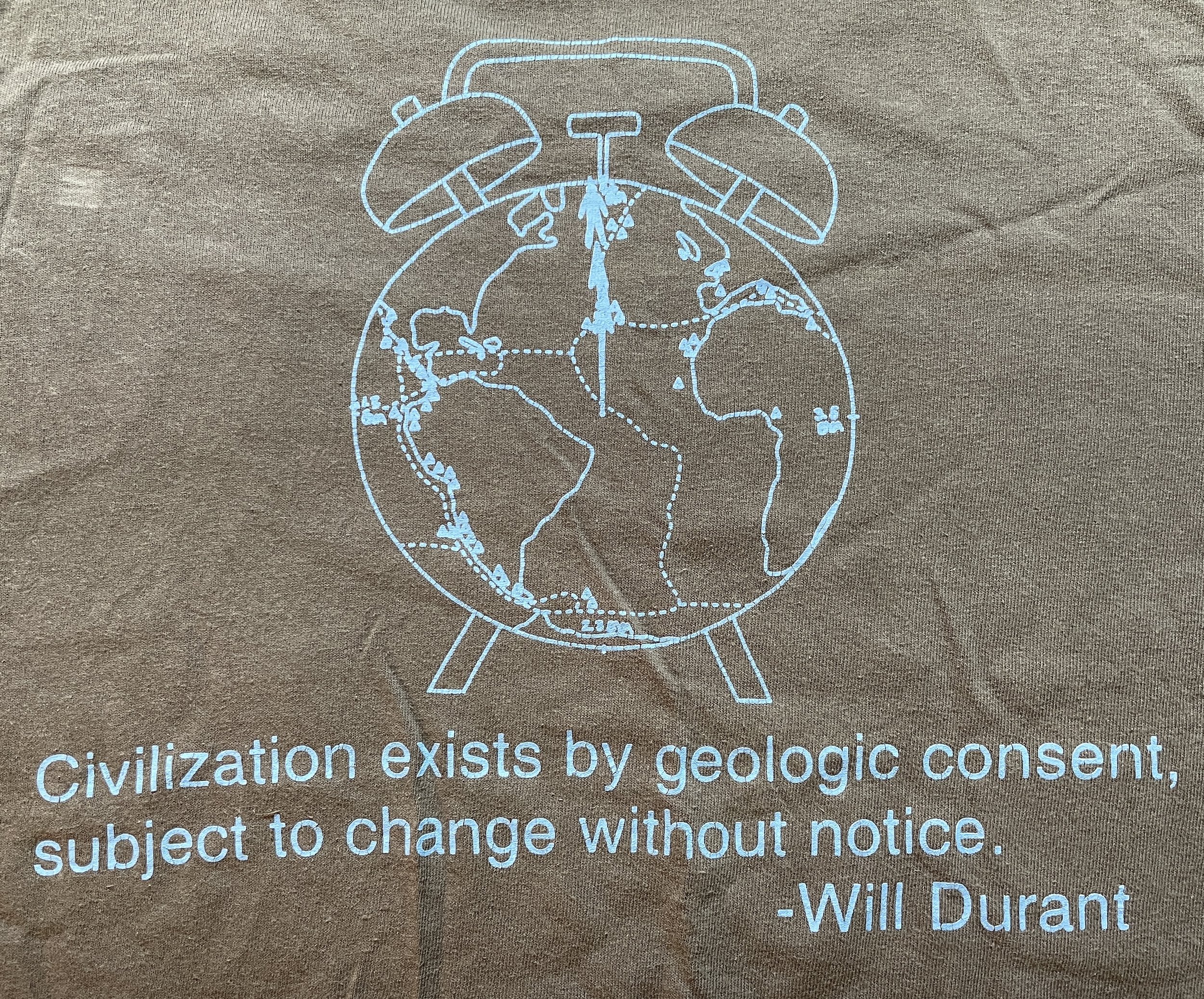
Another memorable quote: “Civilization is a doll’s house built on a living volcano.”
Durant was the accomplished author of The Story of Philosophy (1926) and, with his wife Ariel Durant, the 11-volume The Story of Civilization (1935-1975). This was a serious (but white-male-oriented) essay, written in the aftermath of World War II, and the LHJ included a page of commentary by six (white and male) authors and historians. They included Thomas Mann (Death in Venice, The Magic Mountain), James Hilton (The Lost Horizon, Goodbye, Mr. Chips) and historian Jacques Barzun.
Meanwhile, such magazines and most newspapers have all but disappeared, and the cover of the New York Times Magazine this week is about butt-oplasty. I wonder what Durant and his commentators would have made of that?
For a closer look at how geologic events can ruin your plans, check out my current favorite science book, “The Ends of the World” by Peter Brannen.
20 May 2022

How To Talk Like A Geologist
Walk the walk and talk the talk.
Everyone wants to talk like a geologist, but few have mastered the art. Here are a few suggestions that will make you sound like you have a Ph.D., or at least like a typical geologist such as Pierce Brosnan.
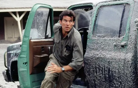
He’s thinking, “I’d better wash the tephra off my Suburban before it sticks.”
• Do not say “fault line.” Faults are surfaces, not lines. Just say “fault.”

“The fault sliced right through the road.” USGS
• Say “outcrop” instead of “outcropping.”
“This outcrop is full of enclaves.”
• A “formation” is a defined rock package, such as the Morrison Formation in Utah, source of many dinosaur fossils, or the Tapeats Sandstone in the Grand Canyon. A formation is not an outcrop or a hill or other physical piece of rock. Delicate Arch is not a rock formation; the Entrada Sandstone from which it was carved is a formation.

Bad: “Manly Beacon is a formation in Death Valley consisting of outcroppings of siltstone.” Better: “Manly Beacon is a bluff in Death Valley cut into siltstones of the Furnace Creek Formation.” Say that at a party and you’ll surely be the center of attention.
• Avoid saying that the mountains were “thrust up,” or the granite was “thrust up,” unless you know that the rocks were indeed placed there by a thrust fault (example: San Gabriel Mountains in Southern California).

El Capitan was produced by erosion. It was not thrust up.
• It is common for beginning students to describe an outcrop as “chunky.” I don’t even know what that is supposed to mean. Avoid.
• Pepper your conversation with cool and ear-catching geological words such as “pluton,” “caldera,” “moraine,” and “tephra” (see Pierce, above).

“For having such a small caldera, Eyjafjallajökull sure blew out a lot of tephra.” Massive bonus points for even trying to pronounce “Eyjafjallajökull,” which, according to Wikipedia, is pronounced “eiːjaˌfjatlaˌjœːkʏtl.” Got it? However, if you say “Eye-yuh” followed by a few random Klingon words, people will think you are fluent. volcano.si.edu
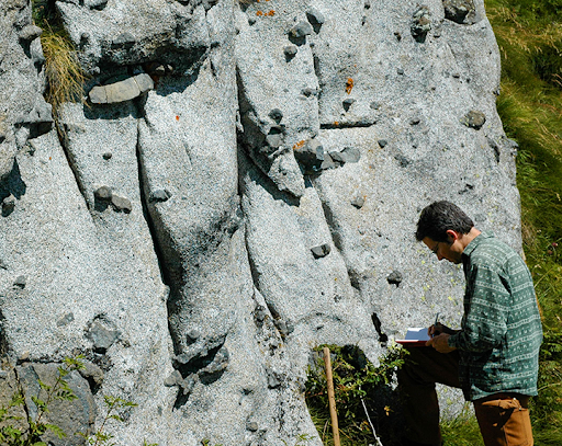
• Remember, geologists do not go on digs. They “do field work,” i.e., they go backpacking on the John Muir Trail, rock climbing in Yosemite, snorkeling in the Caribbean, volcano watching in Hawaii, field-tripping in the Andes, glacier monitoring in Alaska, etc. It’s their job.

Roger Putnam doing field work on the upper part of El Capitan. He is not on a dig. See more about this study here.
• Never, ever, ever, make puns on the words “granite” or “gneiss.” I mean, really…just don’t do it.
5 June 2022